Malaria Early Warning System
In a project funded by NASA SERVIR (2013 - 2015) during my PhD program, we investigated the relationship between malaria occurrence and environmental conditions that could be monitored from space.
Project Background:
Vector-borne diseases are driven by environmental conditions that harbor specific vector habitat conditions such as:
- specific air temperature
- humidity for adult mosquito survival
- surface water for reproduction
The impact of epidemics can be mitigated with prediction and timely deployment of appropriate vector control measures.
Modelling Vectorial Capacity:

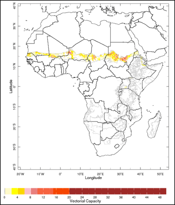
- Vectorial capacity (VCAP) is a measure that expresses malaria transmission risk (receptivity of an area to malaria)
- The first VCAP model developed by U.S. Geological Survey (USGS) and Columbia University was originally driven by satellite estimates of (1) precipitation and (2) land surface temperature
- This model was generally successful in predicting onset timing of seasonal infection spikes, but struggled with predicting duration and intensity
- Our project focused on improving upon this model by incorporating local estimates of surface water area fraction derived from satellite measurements
Case Study: Relating Historical Surface Water and Malaria Occurrence in Eritrea, East Africa
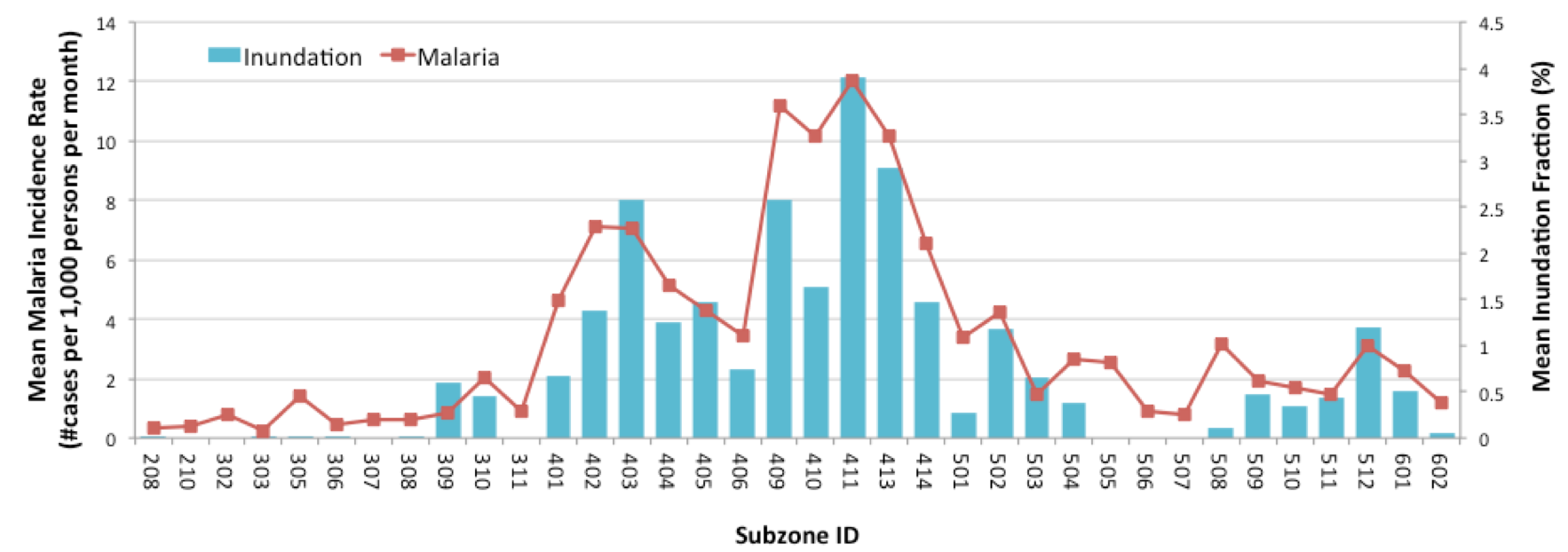
Spatial distribution of mean surface water fraction and mean malaria incidence rate across subzones of Eritrea (excluding coastal zones), 1999-2003:

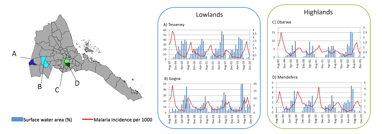
Temporal Dynamic between Malaria and Surface Water Inundation Monthly composites of spatially averaged surface inundation time series compared with malaria occurrence data, Aug 1999 – Dec 2003. Left axis: # Malaria cases per 1000, Right axis: surface inundation (%)

